
Tusheti by 4x4: the Abano road, Omalo and Dartlo
A 4x4 route into Tusheti: the Abano Pass at 2,826 m, tower-studded Omalo with Keselo fortress, and Dartlo village. Season, drive time and what to know.
Tusheti is the hardest-to-reach inhabited corner of Georgia: a mountain region in the far north-east, reached by a single dirt road over the Abano Pass (~2,826 m), and snow shuts that road for half the year. From Tbilisi to Omalo is about 190 km and 5.5-6 hours, half of it a broken switchback track where you need a 4x4 and nothing less. The Tusheti Protected Landscape Administration gives the pass’s season as late May to October; the exact opening day depends on the snow, and after a snowy winter the road opens only around mid-June, or later still. What follows is a point-by-point breakdown: where to switch to a jeep, what the Abano Pass is, what life is like in the tower villages of Omalo and Dartlo, and what to sort out so the trip doesn’t turn into a problem.
First things first: this is a 4x4-only route. Not “preferably” - physically, an ordinary car won’t make it, the surface is built for a high-clearance 4x4. If you don’t own one, people take a jeep with a driver from Tbilisi, Telavi or Alvani, or a seat in a local shared jeep. In spirit it’s the closest cousin of the road into Svaneti: the same high mountains, the same towers, the same need for all-wheel drive.
It is worth spelling out the ways to get there, because they decide both your budget and your nerves. The first option is a private jeep with a driver all the way from Tbilisi: the priciest, but you’re driven door to door with nothing to arrange. The second, and the one locals use most, is to make your own way to Alvani or Telavi and pick up a shared jeep there: old Delicas and Patrols fill up with passengers and head uphill, which is noticeably cheaper but runs on a “when the jeep is full” timetable. The third is an organised tour with transfers and overnights, handy if you would rather not think about any of it. Bringing your own 4x4 only makes sense if you’ve real off-road experience; Abano is no place for your first taste of it.
The season, and why everything hinges on the road
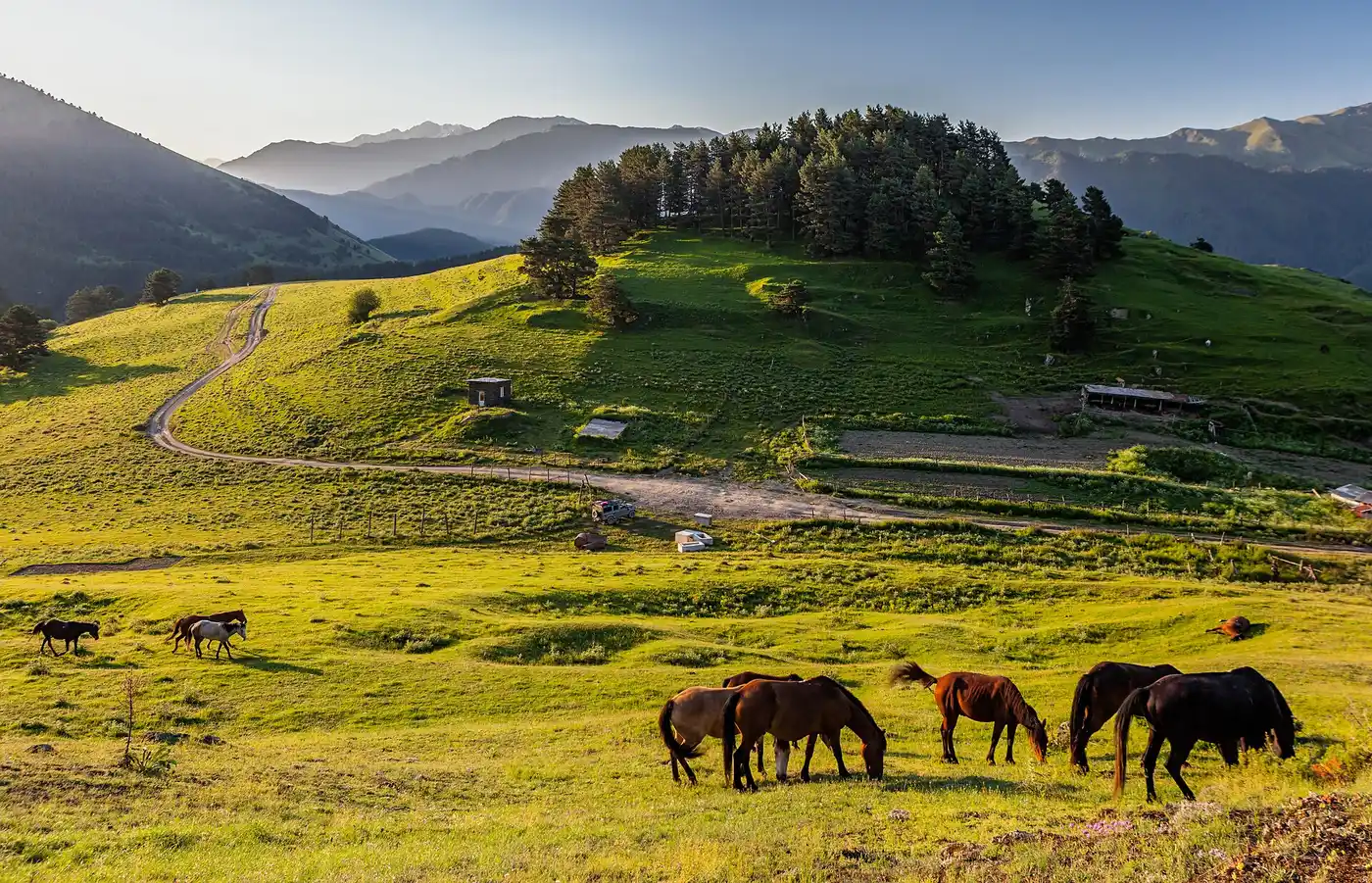
The whole logistics of Tusheti hang on the Abano Pass. Snow usually closes it in October and keeps it shut until late May or June, and that’s no formality: in winter the region all but empties, the locals move down to Kakheti, and the only link with the outside world is by helicopter. So the window is narrow - summer and early autumn; at either end of it, check that the pass is open before you set off. June brings wildflowers on the slopes, July and August the steadiest weather for hiking, September the autumn colours, and in late September the flocks are driven back down the road: if you hit that migration, be ready to sit and wait while the sheep pass.
Even in season the road plays by its own rules. Rain washes out the dirt track and the drive stretches out; the section is sometimes closed for a few hours while the mud clears or the surface is patched. Don’t plan a there-and-back in a single day
- Tusheti is not that kind of place. Allow two nights at least, three is better.
Tbilisi to Alvani: the paved part
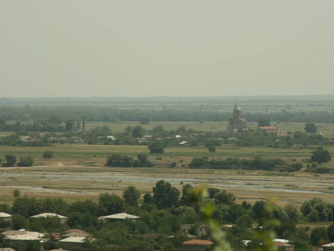
The first hundred-odd kilometres are an ordinary drive through Kakheti. Over the Gombori Pass you drop into the Alazani wine valley, pass Telavi and reach Kvemo Alvani, the last lowland town. This is where the tarmac ends and Tusheti proper begins: you switch to a jeep (if you came under your own steam), fill the tank and take on water. There are no fuel stations higher up at all, and Omalo is still several hours away.
The Abano Pass: the heart of the route
From Alvani to Omalo is about 70 km of dirt and 3.5-4.5 hours of driving. This is the stretch the 4x4 is for: a narrow track cut into the slope, switchbacks with no barrier and drops of hundreds of metres. The climax is the Abano Pass, about 2,826 m, one of the highest drivable points in the Caucasus. Snow lies here even in early summer, and the weather turns on a dime: one moment sun, the next you drive into a cloud where visibility falls to a few metres.
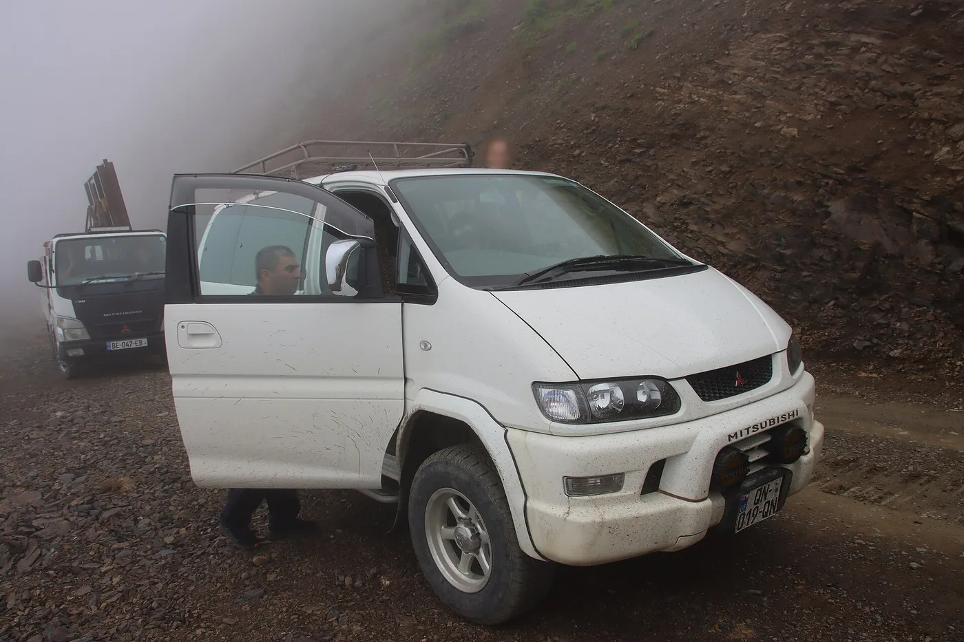
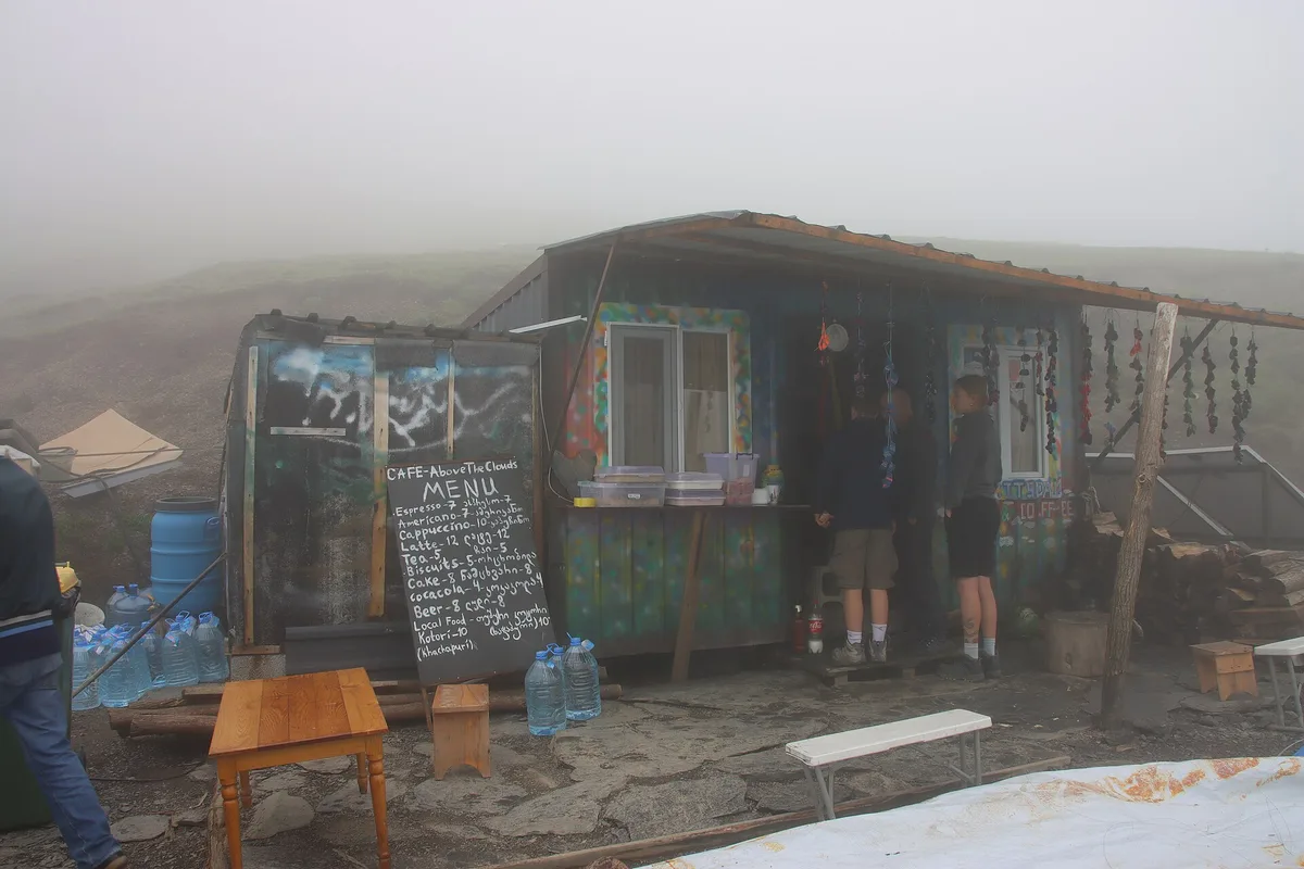
A couple of honest caveats. This road is regularly called one of the most dangerous in the world, and not for nothing: fatal accidents happen here every year, almost always down to reckless or inexperienced driving. Don’t take these switchbacks tired, don’t try to overtake, and do not set off in the evening - you want to be in Omalo before dark. If you have any doubt about your own driving, the best call is a local at the wheel: these people drive Abano every day and know every bend. Right at the top, on the pass itself, there is a tiny cafe called “Above the Clouds” serving espresso and khachapuri - a good excuse to breathe out after the climb.
Omalo and Keselo fortress
Beyond the pass the road drops to Omalo (~1,880 m), the main village of Tusheti and the base for every outing. It splits into Lower and Upper Omalo; higher up, on a rocky ledge, stands Keselo fortress. It was built in the 1230s during the Mongol invasion: it originally had 13 stone towers where villagers sheltered from raids, first by Mongols and later by Dagestani tribes. By the 20th century most of the towers had collapsed, but from 2003 five of them were rebuilt using traditional methods. Climb up to them towards evening: at sunset the towers against the snowy peaks are the definitive shot of Tusheti.
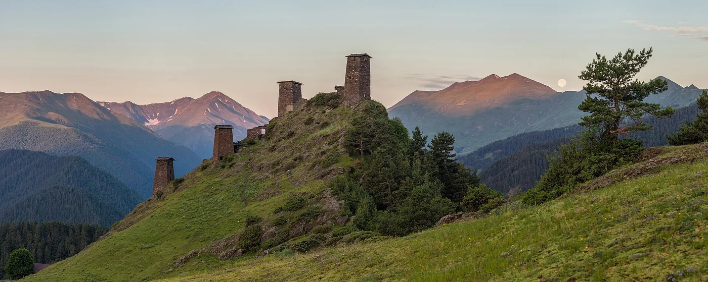
Omalo has places to sleep - guesthouses in local homes, with home cooking and no frills. From here you can walk or drive out to the surrounding villages; electricity isn’t always on and not everywhere, and the mobile signal comes in patches. That’s part of the experience: Tusheti remains a place civilisation has reached only halfway.
A word on the food: Tushetian cooking is noticeably different from what you get in Tbilisi. They make khinkali with lamb, the local sheep’s cheese called guda that even goes into porridge, and kotori - a flat pie of cheese and curd. In the guesthouses this is all cooked at home from their own produce; a vegetarian should warn the hosts in advance, because meat is the base of almost everything here. Dinner is often laid out at a shared table in the evenings, which is probably the best way to get talking with locals and other travellers. When planning your days in Omalo, don’t chase a checklist of villages: half the pleasure is simply living slowly at altitude while summer Kakheti melts down below.
Dartlo: a village of towers
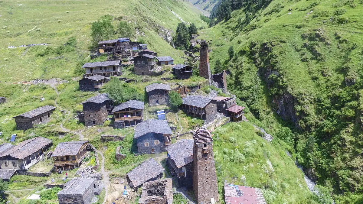
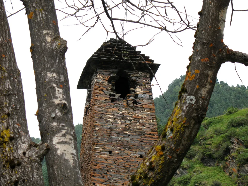
The classic outing from Omalo is to Dartlo, about 12 km up the gorge (~2,000 m). It’s arguably the most beautiful village in Tusheti: dark slate houses cling to the slope above the river, with old stone towers standing between them. There are almost no permanent residents left - the village comes alive only for the warm season, when families return and a couple of guesthouses open. On the slope above Dartlo stands a separate watchtower, Kvavlo; the walk up takes half an hour to an hour and gives the best view of the village from above.
The national park and other villages
Dartlo isn’t the only destination out here. The whole area is part of Tusheti National Park, and about ten marked trails fan out from Omalo - from day walks to six-day treks; a map of the routes is sold at the park visitor centre right in Omalo. If you’re staying more than a day, it is worth heading further up the gorges.
Nearest is Shenako (about 8 km from Omalo), a tidy village with a 19th-century church, and beyond it Diklo (about 15 km) with the remains of a 17th-century fort right on the border. In the other direction is Bochorna: at 2,345 m it’s officially the highest permanently inhabited village in Europe, though “permanently” is relative here - in winter only a handful of people remain. The classic walking loop from Omalo links these very villages: Omalo to Shenako to Diklo and on through the gorge. Even with a jeep, some of the stretch between villages is better done on foot - the scale of the mountains feels completely different from the trail than from behind glass.
Things to know
- 4x4 and a sober driver only. The Abano road doesn’t forgive mistakes; the fatal accidents here are almost always down to recklessness. Do not drive it in the evening or when tired.
- Border zone. Part of Tusheti borders Russia’s Dagestan and Chechnya; some remote areas need a permit. Check at the entrance and with the national park administration - the rules change, so don’t invent them.
- Cash. There are no ATMs in Tusheti and nowhere to pay by card. Bring enough lari for all your days.
- Signal and power are intermittent. Download offline maps in advance and do not count on steady internet.
- Fuel is in Alvani. You cannot buy any higher up; set off with a full tank and a reserve.
The easiest way to sort a 4x4 for this route is to arrange it in advance - see the car hire section. If the idea of high-mountain towers and switchbacks appeals, routes in the same spirit run into Khevsureti, with Shatili and Mutso and Svaneti, Mestia and Ushguli; for other plans, see the routes section.
Route day by day
- Days on the road
- 3
- Distance
- ≈190 km
- Budget from
- 250 GEL
- Best season
- June, July, August, September, October
The route at a glance
-
Tbilisi
Route startThe start, on tarmac through Kakheti. The road to Alvani is ordinary; the real Tusheti begins beyond the pass.
-
Kvemo Alvani
110 km from the startstop ≈30 min
The last lowland town in Kakheti. This is where you switch to a 4x4, fill the tank to the brim, and the dirt road starts climbing.
Photo: Aleksey Muhranoff / Wikimedia Commons, CC BY-SA 3.0 ( source) -
Abano Pass
155 km from the startstop ≈20 min
The highest point of the road, about 2,826 m - one of the highest drivable passes in the Caucasus. Switchbacks with no barrier; snow lingers even in early summer.
Photo: Draceane / Wikimedia Commons, CC BY-SA 4.0 ( source) -
Omalo (Keselo)
190 km from the startstop ≈180 min
The main village of Tusheti (~1,880 m), your base for the nights. Above Upper Omalo stands Keselo fortress: 13th-century stone watchtowers.
Photo: Moahim / Wikimedia Commons, CC BY-SA 4.0 ( source) -
Dartlo
202 km from the startstop ≈180 min
A village in the gorge, ~12 km from Omalo: slate houses and stone towers by the river. On the slope above it stands the Kvavlo watchtower, a walk up on foot.
Photo: Paata vardanashvili / Wikimedia Commons, CC BY-SA 4.0 ( source)
Route map
The map with stops loads on click - to keep the page lightweight.
The map didn’t load. Check your connection and refresh the page.