
Vardzia cave town: what to see and how to get there
Vardzia cave monastery in southern Georgia: ticket prices, hours, the 2026 trail closure, and how to get there from Tbilisi, Akhaltsikhe or Borjomi.
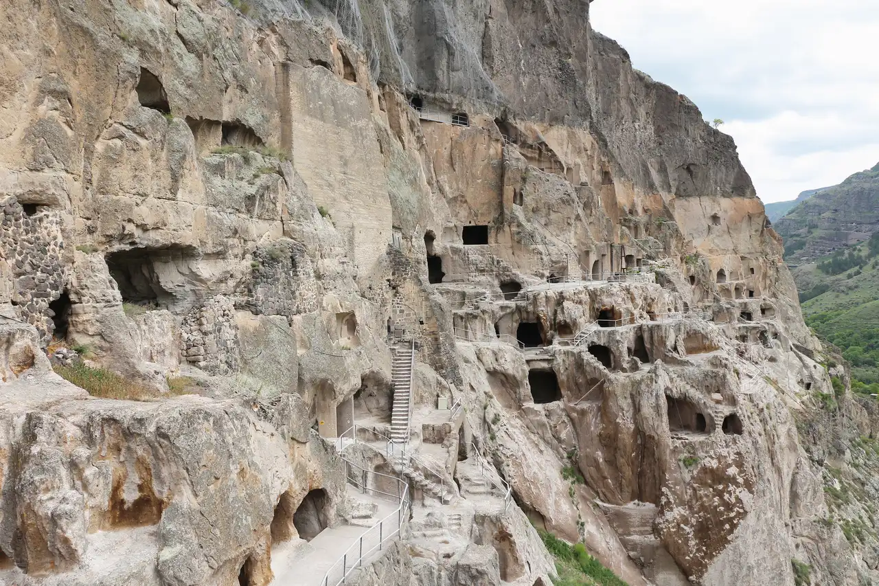
Vardzia is a 12th-century cave monastery cut into the slope of Mount Erusheti, on the left bank of the Mtkvari, built under King George III and finished on a grand scale by his daughter, Queen Tamar. It’s one of the largest rock-hewn complexes in the country, and unlike a museum you walk through in an hour, Vardzia asks for a proper half-day: a steep climb through caves, tunnels and a still-active church, with views over the river valley the whole way.
History: from royal fortress to earthquake ruin
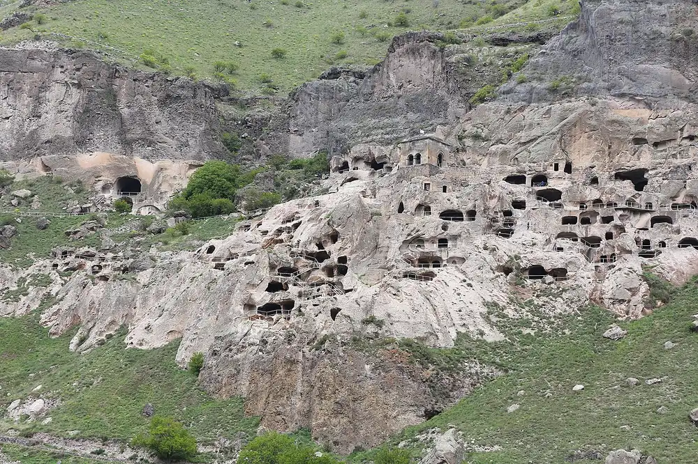
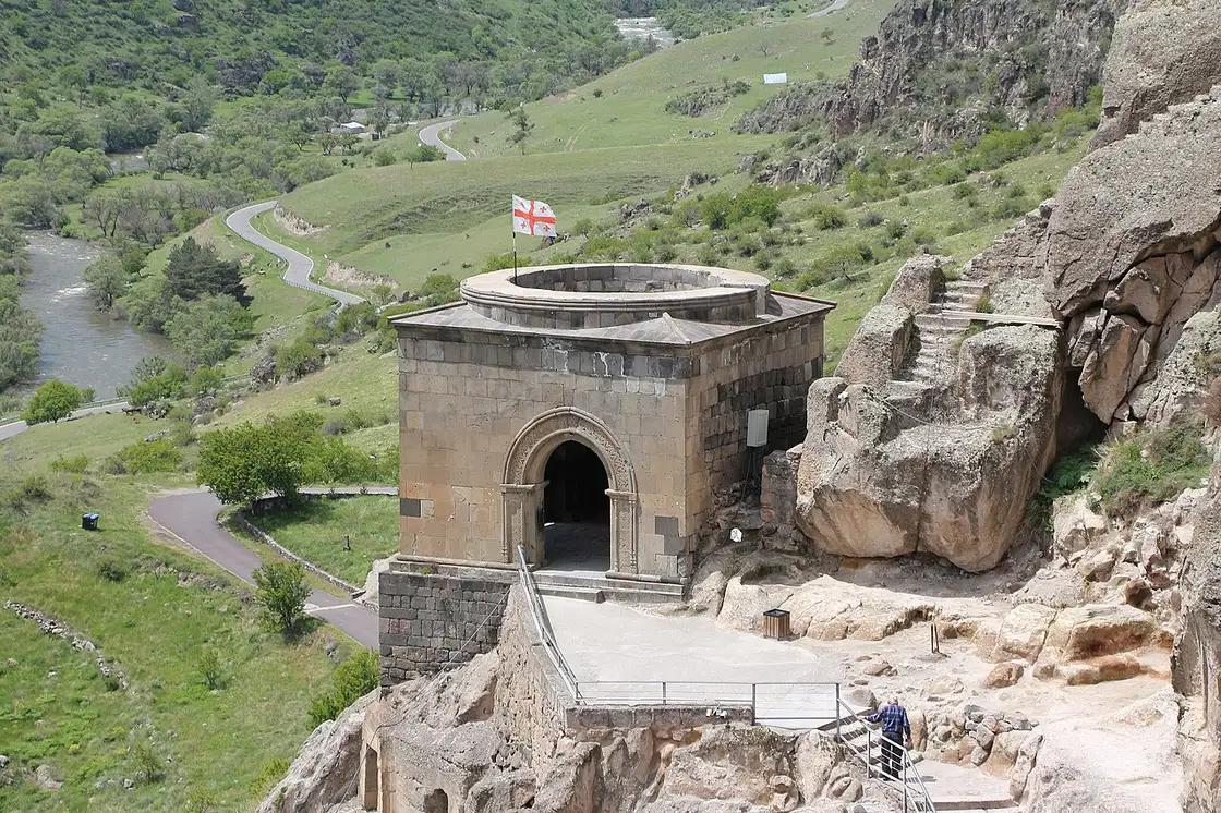
One local legend explains the odd name: as a girl, Tamar is said to have got lost in the caves while out hunting with her uncle, and called back to him, “Ak var, dzia” - “I’m here, uncle.” True or not, it’s a nicer story than most place names get. Vardzia wasn’t built for scenery. George III began cutting shelters into this cliff as a refuge, and the design served that purpose: from the valley there was nothing to see. Tamar’s court then turned the fortress into a full monastery, and it’s that second life, not the first, that most of the ruins belong to. Its heart, the Church of the Dormition, was cut and painted between George’s death in 1184 and her marriage in 1186, and its frescoes with an early portrait of Tamar are still considered a key monument of medieval Georgian painting. Between 1186 and the Battle of Basiani around 1203, the builders added most of the remaining dwellings along with the defences, a water supply and an irrigation network.
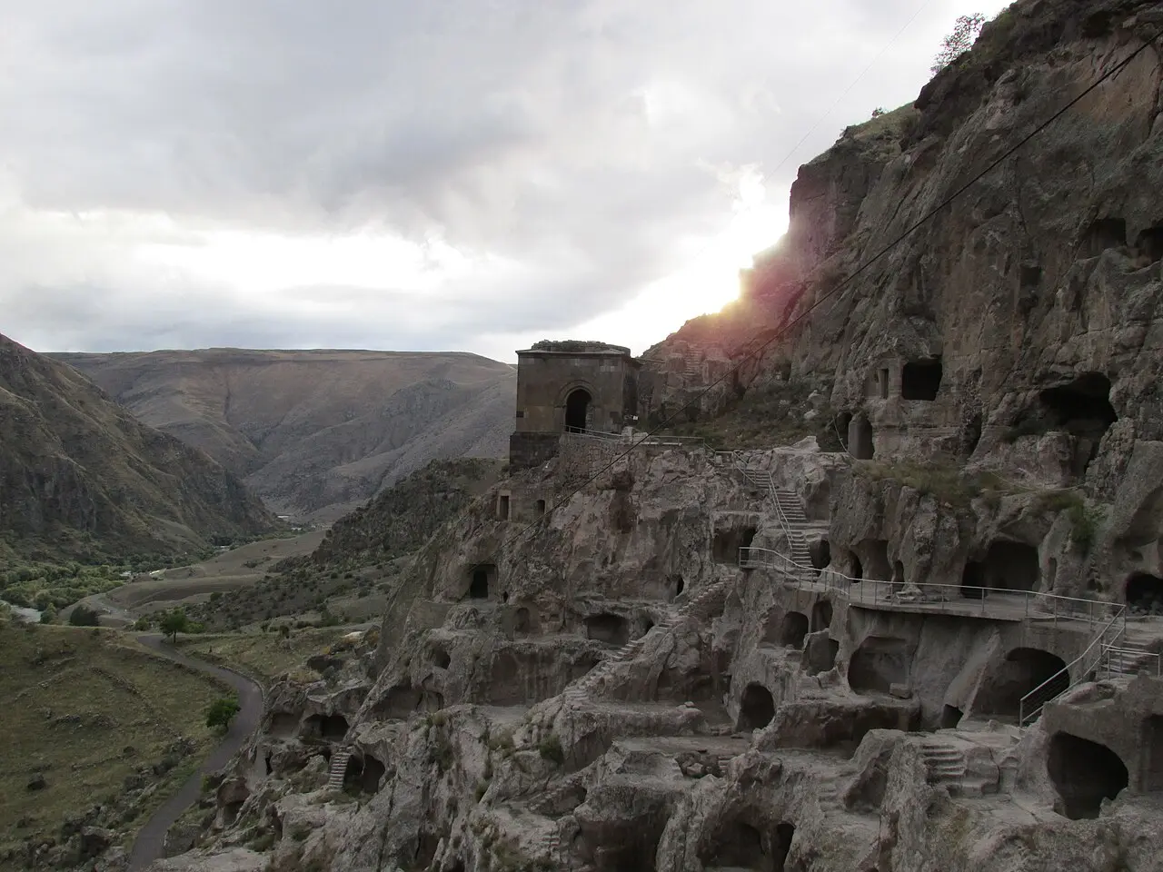
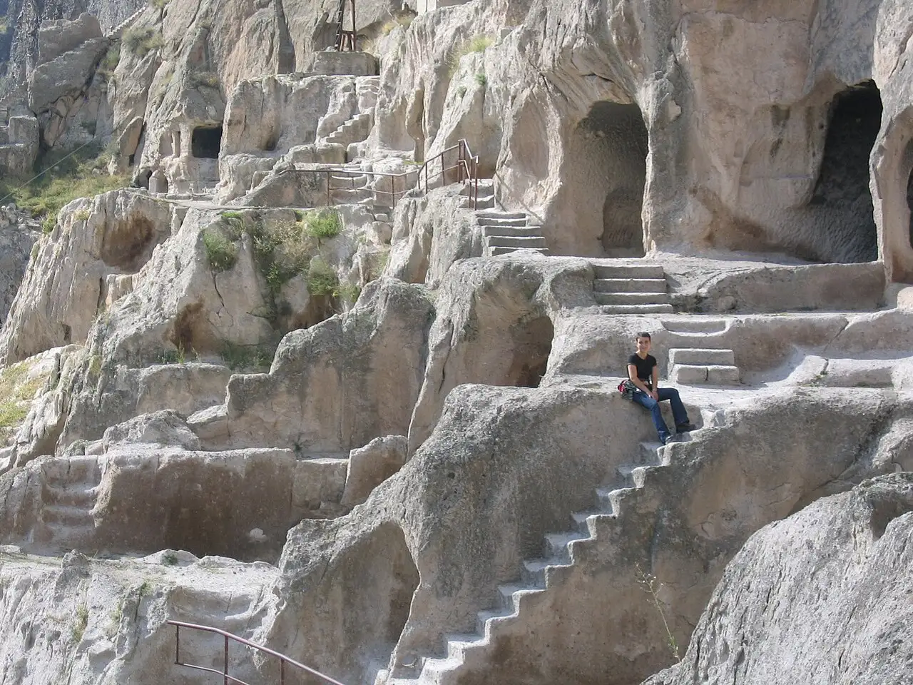
For a while the plan worked exactly as intended: the town stayed sealed inside the cliff, invisible from below. What you see from the valley today is largely down to the 1283 earthquake, which sheared off the outer rock face and exposed tiers that had never been visible before. According to Georgian chronicles, the complex survived Mongol raids in the 1290s, only to be sacked by Persian forces under Shah Tahmasp I in 1551. When the Ottomans took the region in 1578, the monks finally left, and Vardzia stood empty for centuries. Georgia’s tourism board puts the cliff face at roughly 900 metres long and around 40,000 square metres in area, with 242 caves preserved today in whole or in part. The heritage agency describes what was cut here as a thirteen-storey complex with hundreds of halls large and small, so what you climb through today is a fraction of it - you’re walking the front rows of something much deeper.
Tickets, hours and the 2026 trail closure
Entry to Vardzia costs 15 GEL for an adult, and Georgian citizens who are pupils, students or pensioners pay just 1 GEL (the heritage agency’s own tariff). A guide in Georgian is 25 GEL, and if you’d rather have one in another language it’s 45 GEL, an audio guide or a virtual tour both run 15 GEL, and the shuttle up to the caves is 2 GEL per person. Children under 6, people with disabilities and their companions, and ICOM cardholders get in free. The agency’s published hours are 10:00 to 19:00, daily except Monday, though a 2026 field guide by Emily Lush describes the site as open every day of the week - gate staff will know which is currently true. In May 2026 a rockfall near the so-called Secret Tunnel damaged part of the footpath and its safety barrier, and the affected stretch was closed. The same field guide reports that in June 2026 visitors were still being turned back at that point and walked out the way they came in, instead of finishing the usual loop. There’s no guarantee any of this still applies by the time you go, so check with staff on site instead of planning your exact route in advance.
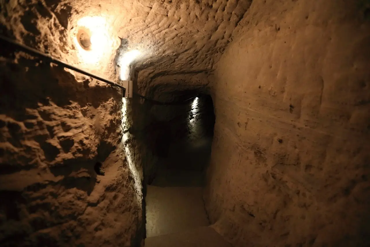
Inside the cave town
The layout climbs in tiers linked by internal staircases and tunnels, so you can move between levels without doubling back down to the valley floor each time. In its heyday Vardzia is said to have held around 28 wine cellars storing some 235 clay qvevri; only a handful of those cellars can still be made out today, the rest lost along with everything else the earthquake and the following centuries took. The Church of the Dormition remains the obvious highlight: modest in scale but rich in fresco work, with the donor portraits of George III and Tamar giving you one of the few surviving images of the queen from her own lifetime. Elsewhere the caves thin out into smaller cells, storerooms and chapels, most of them bare rock now but still legible as rooms people actually lived and worked in. The complex sits fully exposed on the cliff face, so there’s no shade once you’re past the entrance, and the stone floors and steps are uneven underfoot, so proper shoes matter more here than at most cave sites.
Best time to visit
Spring and autumn make the climb far more comfortable than summer does: the bare rock face holds heat and throws it straight back at you, and by midday in July or August the exposed stairways can feel like an oven with no shade to retreat to. Go early or late in the day if you’re visiting in summer. Winter brings its own hazard rather than heat: the carved steps can ice over, and a fall on stone is a serious fall, so slower, careful footing matters more than layers of clothing.
How to get there
Both the tourism board and the heritage agency put Vardzia at 300 km from Tbilisi; the road through Borjomi and Akhaltsikhe measures about 275 km. Either way it’s 4 to 5 hours depending on traffic through the mountains. If you don’t want to drive the whole way, the heritage agency’s own page names two public options: a direct bus or minibus from Tbilisi via Aspindza, or the train from Tbilisi to Akhaltsikhe followed by a minibus onward to Vardzia. From Akhaltsikhe itself it’s about 61.5 km, roughly an hour’s drive; from Borjomi it’s around 107 km, closer to two hours. The closest sizeable town is Aspindza, about 30 km and half an hour away, and Khertvisi Fortress sits right on that same road, an easy stop on the way in or out.
Vardzia by car or by tour
A rental car gives you the freedom to combine Vardzia with Rabati Fortress, Khertvisi and other stops along the Mtkvari valley in a single loop, and you can linger at each stop as long as you like, which matters given how far south this corner of Georgia sits. It’s a long day of driving either way, mostly on mountain roads, so pace yourself and don’t plan anything demanding for the evening afterward. A day tour from Tbilisi or an organised trip along the whole southern route takes that decision off your hands, handles the ticket queue, and usually pairs Vardzia with Rabati Fortress in Akhaltsikhe. If Vardzia is the only thing you want to see down here, take the tour: four or five hours of mountain road each way is a lot to give up a day to. If you want Khertvisi and the Mtkvari valley too, drive.
Nearby
To the south, on the road through Akhaltsikhe, stands Rabati Fortress, easy to fold into the same trip, and Khertvisi Fortress marks the turn toward Vardzia itself. There’s a ready-made two-day plan in Vardzia and the south in 2 days that strings all three together with Borjomi. Given the distance involved, car hire and travel insurance are both worth sorting out before you set off. More places across the country are in the things to see section.
Photos
On the map
The map loads on click - to keep the page lightweight.
The map didn’t load. Check your connection and refresh the page.
Admission and opening hours
- Admission price
- Entry 15 GEL adult; Georgian citizens who are pupils, students or pensioners 1 GEL; guide in Georgian 25 GEL, in a foreign language 45 GEL; audio guide 15 GEL; virtual tour 15 GEL; shuttle (per visitor) 2 GEL; under 6, ICOM cardholders and people with disabilities free
- Opening hours
- 10:00-19:00 daily except Monday, per the heritage agency; some 2026 field reports describe it as open every day, so it is worth asking at the gate
A May 2026 rockfall near the so-called Secret Tunnel damaged part of the footpath and its barrier, closing that stretch; by the latest field reports, from June 2026, visitors were still being turned back there and walked out the way they came in. Ask at the ticket office how the loop runs on the day.
Details checked: September 12, 2026
Distance
- Tbilisi ≈300 km · 4-5 h via Borjomi-Akhaltsikhe-Aspindza, per Georgia's national tourism board
- Kutaisi ≈230 km · 4-5 h via Khashuri-Borjomi, approximate
- Batumi ≈230 km · 6-7 h via Khulo and the Goderdzi Pass (mountain road - check it is open), approximate
Read also

What to see · 10 min read
Skiing in Georgia: Gudauri vs Bakuriani
Updated · September 5, 2026Gudauri or Bakuriani: 2025/26 day passes 70 vs 55 GEL, elevations, last season dates, who each resort suits and how to get there.

What to see · 7 min read
Svaneti travel guide: Mestia, Ushguli and towers
Verified · August 25, 2026Svaneti mapped: Mestia vs Ushguli, tower villages, season, and how to link town guides, the trek, and the road from Tbilisi.

What to see · 9 min read
Resorts near Batumi: Gonio, Kvariati & Tsikhisdziri
Updated · September 2, 2026Where to stay near Batumi for cleaner, quieter beaches: Gonio and its Roman fort, Kvariati for diving, and secluded clifftop Tsikhisdziri - how to choose.

What to see · 10 min read
Georgia with kids 2026: family beaches & resorts
Updated · July 18, 2026Georgia with kids: sandy, shallow beaches up north (Ureki, Shekvetili, Kobuleti), amusement parks, when to go and how to plan a family trip.