
Kutaisi: what to see, where to eat, how to get there
 Verified · June 15, 2026 against the operator’s own page 8 min read
 Kutaisi - Georgia's third city and ancient capital of Colchis: Bagrati Cathedral, the Colchis Fountain, the Rioni. What to see in and around.
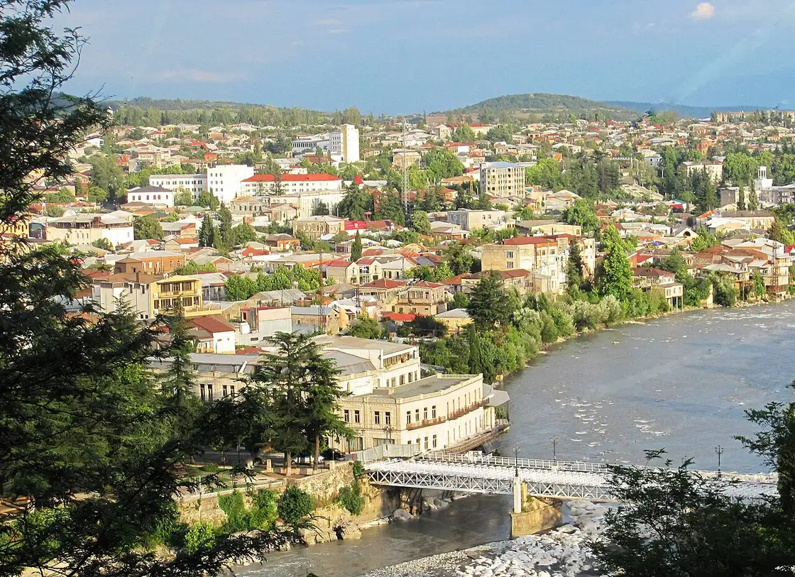
Kutaisi is Georgia’s third-largest city and the centre of Imereti, 221 km west of Tbilisi on the Rioni River. It’s one of the oldest continuously inhabited cities in the world: in the 6th-5th centuries BC it was the capital of Colchis - the very land of the Golden Fleece, where the Argonauts sailed. Today Kutaisi is a calm, green city and the main base for trips around western Georgia.
A little history
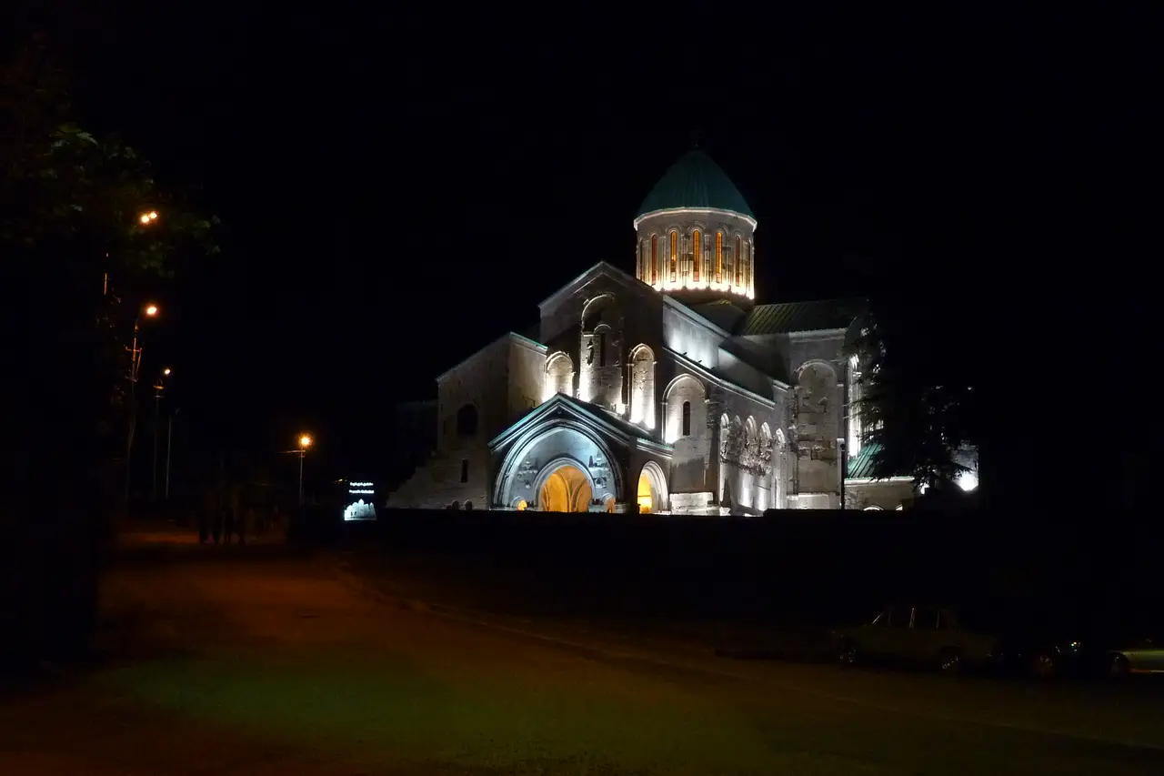
After Colchis, Kutaisi found itself at the heart of Georgian history more than once: from 1008 to 1122 it was the capital of the unified Kingdom of Georgia, and later, from the 15th century until 1810, the capital of the separate Kingdom of Imereti. That era is recalled by Bagrati Cathedral, built by King Bagrat III in the early 11th century and visible from almost anywhere in the city.
In our own time the city briefly became the “second capital” again: from 2012 until January 2019 the Georgian parliament sat here. The purpose-built parliament building didn’t stand empty for long: in July 2026 the government reopened it as the Kutaisi Technology Hub, with startup space, an AI computing centre and a branch of the TUMO technology school for teenagers. Kutaisi is now home to around 123,000 people.
What to see
Bagrati Cathedral. The city’s main symbol stands on Ukimerioni Hill above the centre. The early-11th-century church was badly ruined in the past and restored in modern times; from the platform nearby you’ll get a panorama of Kutaisi and the Rioni.
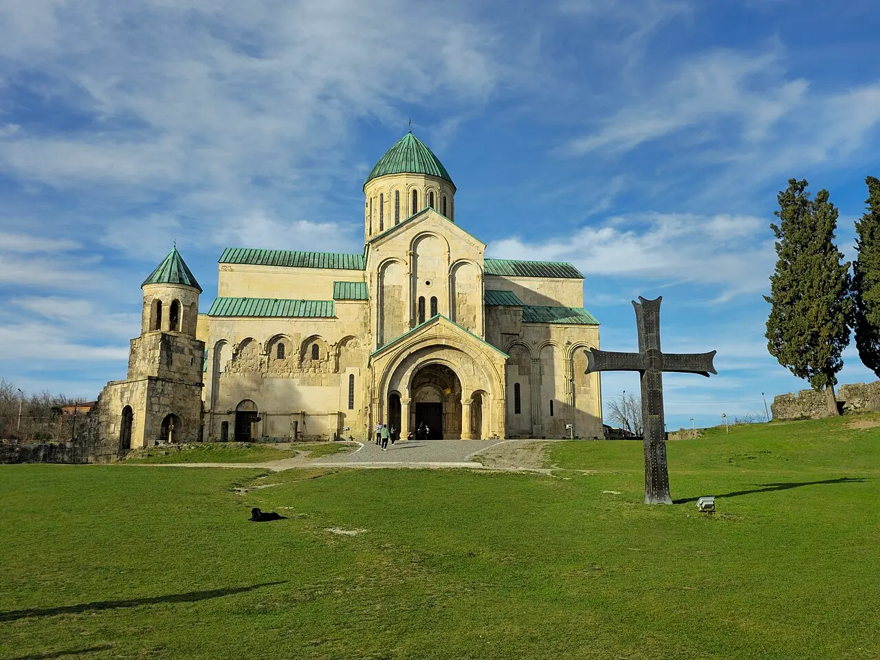
Bagrati was inscribed on the UNESCO World Heritage list together with Gelati Monastery back in 1994. The reconstruction that gave the cathedral its current look proved controversial enough that UNESCO delisted Bagrati alone in 2017, while Gelati kept its status - one reason the two sites, a few kilometres apart, now feel so different when you visit.
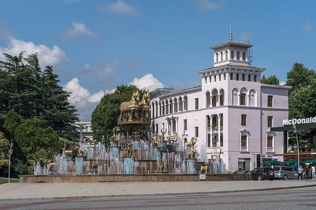
The Colchis Fountain and the central square. The heart of the city is a large fountain with gilded figures: these are enlarged copies of ancient Colchian ornaments - aurochs, horses, deer and figures of a tamada (toastmaster) found by archaeologists. The fountain’s a direct reference to the age of Colchis and is beautifully floodlit in the evening.
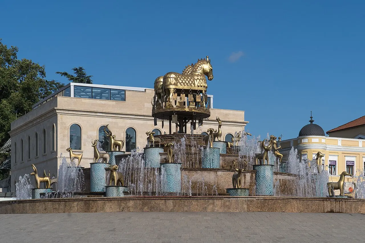
Around the fountain lies the central square with its old buildings, cafés and a theatre: the Meliton Balanchivadze Opera and Ballet Theatre, named after the composer whose son, George Balanchine, later became one of the twentieth century’s most influential choreographers. It’s a handy place to start a walk around the city.
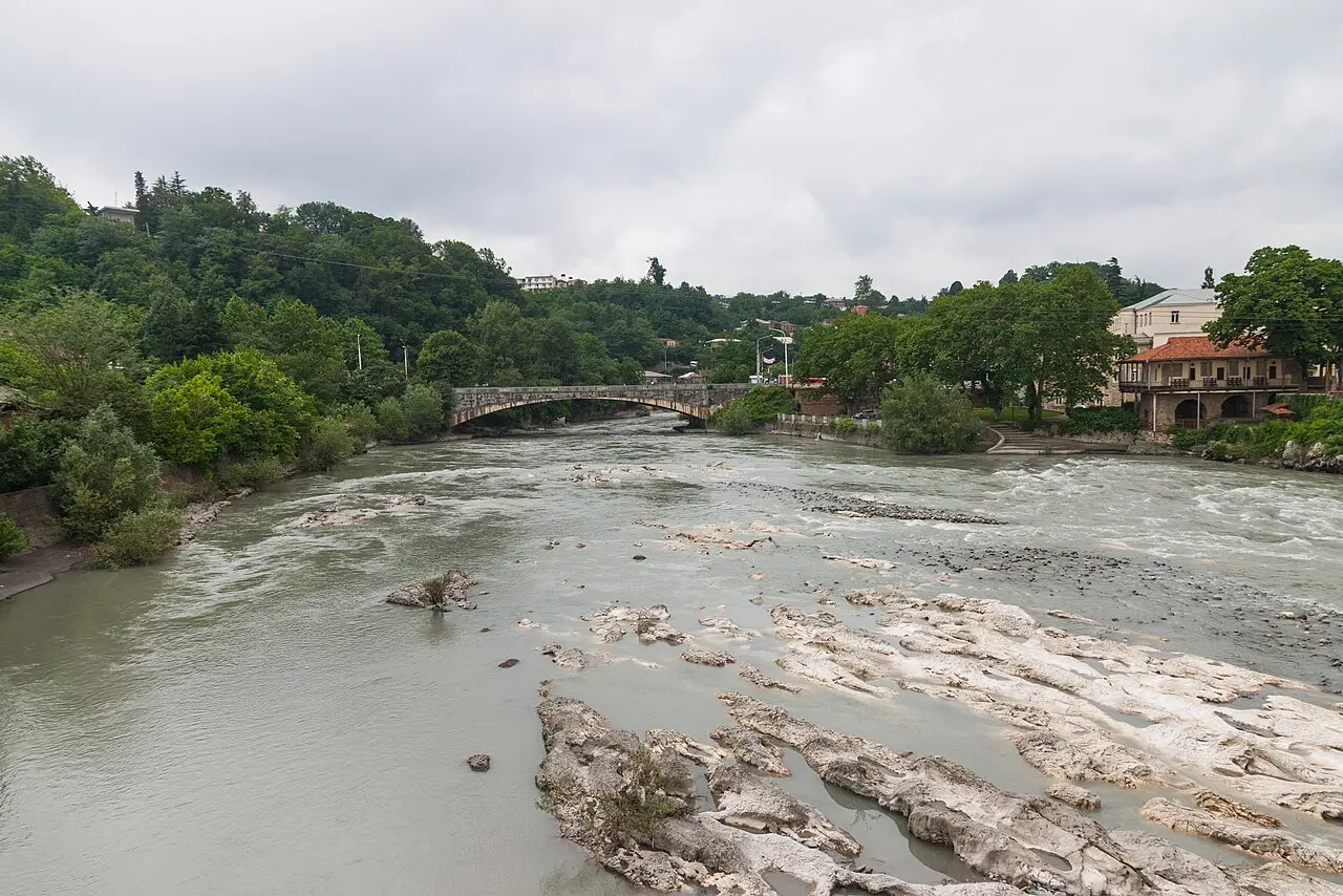
The White Bridge and the Rioni River. Over the turbulent Rioni, which cuts through the city, runs the old pedestrian White Bridge (Tetri Khidi). A walk along the embankment and through the neighbouring quarters with their old houses is the best way to feel Kutaisi’s unhurried rhythm.
The Kutaisi State Historical Museum. Housed in the former National Bank of Georgia building near the centre, the museum holds more than 200,000 items spanning from the 9th century BC to the late medieval period - a good rainy-day stop for anyone curious what “Colchis” actually left behind beyond the fountain outside.
The Green Market. A short walk from the centre, Kutaisi’s daily produce market (locally just “Bazroba”) is where Imeretian cheese, honey, dried fruit, spices and churchkhela are sold straight off farm tables. It’s busiest in the morning, and it’s a good place to taste things before deciding what to bring home - cheese and churchkhela both travel reasonably well. Bring cash: this is a working farmers’ market, not a tourist bazaar, and card readers are rare at the individual stalls.
Nearby
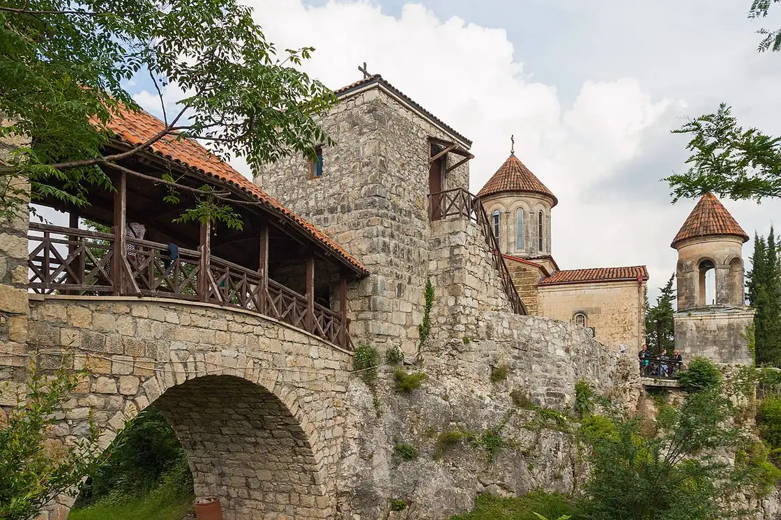
The main reason to linger in Kutaisi is the surroundings. A few kilometres to the east is the 12th-century Gelati monastery, a UNESCO World Heritage Site with unique mosaics, and beside it the Motsameta monastery on a cliff above a canyon.
To the north are the karst Prometheus Cave, with its underground halls and river, and Sataplia with its dinosaur footprints. A little further on lie the Okatse and Martvili canyons, while on the way to Chiatura stands the Katskhi Pillar, a church perched atop a 40-metre rock.
About 15 km away by road is Tskaltubo, once a Soviet elite spa town: its radon-carbonate springs still run warm, and its grand abandoned sanatoriums have become one of the most photographed ruins in the country. In the other direction, about 26 km south-west, the small town of Vani holds the Vani Archaeological Museum, where the Georgian National Museum keeps Colchian gold and bronze dating back to the 8th-7th centuries BC, pulled from the same land the Golden Fleece myth describes - a direct link back to the story Kutaisi opened with.
And if you feel like climbing higher into the mountains, the road up to Racha starts from Kutaisi - a quiet wine region with the villages of Oni and Utsera and the high Shovi valley, a separate two-day road trip through Racha.
How much time to give Kutaisi
Plenty of travellers land at the cheap-flight airport here and push straight on to Tbilisi or the coast the same day. That’s fine if you only want to say you’ve passed through, but it misses the point: the centre itself is a half-day at most, and what makes the stop worthwhile sits within an hour or two of it. Bagrati, the fountain, the square and the White Bridge are all close enough to walk between, so pair them with the Green Market and a slow lunch and you’ve got a full, unhurried day. Add a morning at Gelati and Motsameta, an afternoon at Sataplia or the Prometheus Cave, and a full day for the Okatse or Martvili canyon, and two or three nights here stop feeling like a lot of time. That’s roughly what most budget-flight arrivals end up doing anyway - a night or two in Kutaisi before moving on, not the same day they land.
If you only have two days, a simple split works well: spend the first on the centre itself (Bagrati, the fountain and square, the museum or the market, depending on your pace) and the second on Gelati and Motsameta in the morning with Sataplia or the Prometheus Cave after lunch. With a third day, add Okatse or Martvili, or swap it for Tskaltubo if abandoned Soviet architecture interests you more than another canyon.
What to keep in mind
Many budget airlines fly through Kutaisi airport, so the city often becomes the first stop in Georgia - a handy place to begin a route around the country. The centre itself is compact and easily walked, while the surrounding sights are most easily reached by car or on a tour: the car hire section comes in handy. Imereti is also noticeably wetter than eastern Georgia - the region averages around 1,500 mm of rain a year, spread across the seasons rather than bunched into one - so a light rain jacket earns its place in the bag whatever month you travel. Rugby runs deep here too: Kutaisi’s Aia Arena (built in 2015, capacity around 4,860) is home to Aia Kutaisi, one of Georgia’s most decorated clubs, with three Soviet-era national titles in the late 1980s and more since - worth checking the fixture list if a match falls during your visit.
For where to try Imeretian cuisine (and the famous Imeretian khachapuri), see our where to eat in Kutaisi guide. From Tbilisi by land, see train, bus and transfer; the wider rail picture is in trains in Georgia; from the airport see from Kutaisi airport and the transport section. The country’s other cities are in the cities section, and the full list of places is in the things to see section.
Photos
On the map
The map loads on click - to keep the page lightweight.
The map didn’t load. Check your connection and refresh the page.
Distance
- Tbilisi ≈221 km · ~3.5 h train or car
- Kutaisi The western hub: the David the Builder international airport (budget airlines), trains and buses across the country
- Batumi ≈150 km · ~2.5 h car or train along the coast
Read also

Cities · 10 min read
Ureki: black magnetic sand and a shallow sea
Updated · July 20, 2026Ureki, Guria's sandy resort: black magnetic sand, a shallow warm sea and easy family beaches. Where to stay, when to go and how to get there.

Cities · 10 min read
Borjomi town: the spa resort and a mountain base
Updated · June 16, 2026Borjomi spa town in its wooded gorge: the mineral-water park, the Likani palace, the old railway and a base for Bakuriani and Borjomi-Kharagauli.

Cities · 12 min read
Batumi: beaches, boulevard, what to see and where to stay
 Verified · June 15, 2026
 Batumi, Georgia's Black Sea resort: beaches, the palm boulevard, Alphabet Tower, Piazza and skyscrapers. What to see, where to stay and how long.

Cities · 4 min read
Gori: Stalin Museum and the Uplistsikhe cave city
Updated · June 14, 2026Gori in Shida Kartli, where the Kura meets the Liakhvi: a hilltop fortress, the Stalin museum and the Uplistsikhe cave city nearby.